
Humminbird 4113701 - Fish Finder
Product Description
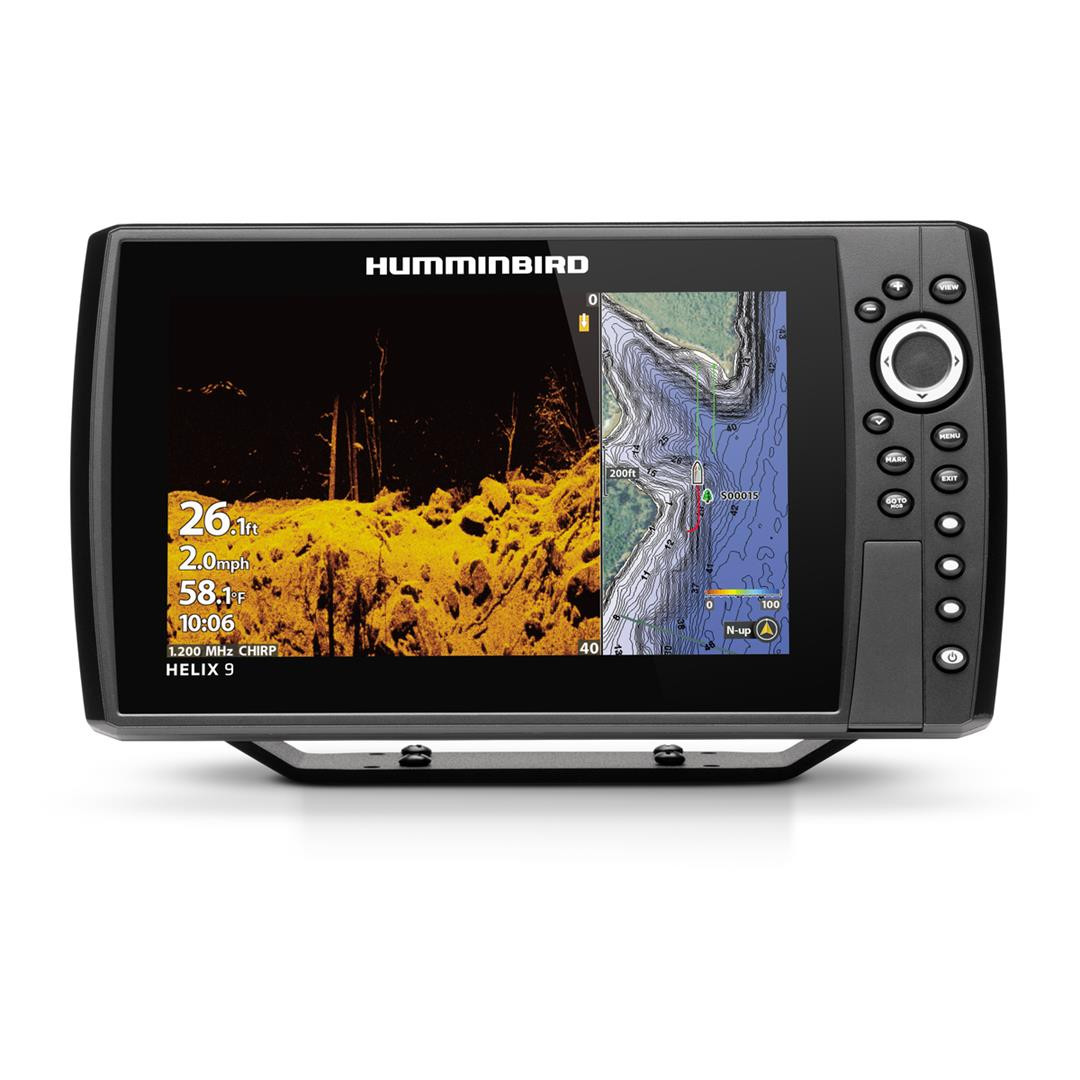
The HELIX 9 CHIRP MDI+ GPS G4N features a 9 Inch display, MEGA Down Imaging+, Dual Spectrum CHIRP Sonar and internal GPS with Humminbird Basemap. As with all HELIX G4N models, this HELIX 9 standard features such as AutoChart Live, Wi-Fi and NMEA 2000 (R), in addition to Bluetooth (R) and Ethernet networking for compatibility with the One-Boat Network ™ family of products from Humminbird, Minn Kota and Cannon.
Fish Finder; Helix 9 Mega Di+; Use To Find Fish And Identify Buoys/ Day Markers/ Hazards/ Marinas/ Contours/ Depth Markers; 9 Inch LCD Display; 1024 x 600 Pixels Resolution; Keypad Control; Bluetooth Compatible; 12 Inch Length x 7 Inch Height x 4.13 Inch Depth; 1000 Watt Output; With Built-In G4N GPS/ Built In Mapping/ Down Imaging/ MEGA Imaging+/ Networking/ WiFi; Waterproof; Dual Spectrum CHIRP Sonar; With XM 9 HW MDI Transducer/ Control Head/ Power Cable/ Gimbal Mounting Bracket/ Mounting Hardware/ Screen Cover
Attributes
Display Size: 9 Inch LCD
Display Resolution: 1024 X 600 Pixels
Overall Dimensions: 12 Inch Length X 7 Inch Height X 4.13 Inch Depth
Sonar Compatibility: Dual Spectrum CHIRP Sonar
With Built-In GPS: Yes
Mount Type: Gimbal Bracket Mount
With Transducer: Yes
Used To: Use To Find Fish And Identify Buoys/ Day Markers/ Hazards/ Marinas/ Contours/ Depth Markers
Interface: Keypad
Waterproof: Yes
Point Of Interest: 2750 Waypoints
SD Card Storage: Micro SD Card
Features & Benefits
MEGA Live Delivers The Clarity And Detail Of MEGA Imaging In Live-Action, Allowing Anglers To See Fish And Structure In Real-Time
MEGA Down Imaging Displays 3X The Output Of Standard Down Imaging
CHIRP Stands For “Compressed High Intensity Radar Pulse”: By Covering A Wide Range Of Frequencies, CHIRP Produces More Accurate, More Detailed Returns Of Fish, Structure And The Bottom
Dual Spectrum CHIRP Sonar: By Covering A Wide Range Of Frequencies, CHIRP Produces More Accurate, More Detailed Returns Of Fish, Structure And The Bottom
Precision GPS Provides An Accurate Position Fix, Meaning More Accurate Waypoints And Boat Positioning For Better Fishing
Humminbird Basemap: Based On Freshwater Data From LakeMaster And NOAA, These Maps Provide A Clear View Of Underwater Terrain
LakeMaster Lake Maps Features Unrivaled, Easy-To-Read Contours, Highlighted Depth Ranges, Scrollable Lake Lists And More
Maps Features All Of The Of LakeMaster With One Key Addition: Aerial Photography Of High Definition Lakes, Providing Visibility To Docks, Buildings, And Structure
SmartStrike Cards Combine High Definition LakeMaster Lake Map Data And Extensive Search Algorithms To Help You Pattern And Locate Fish At Any Time Of The Year
Limited 2 Year Warranty